
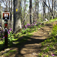
Blue Ridge Parkway Hikes
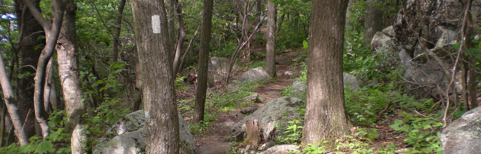
Hundreds of hiking trails are tucked away within the 469 miles of the Blue Ridge Parkway. These trails provide dazzling images of wildflowers on rolling pastures, cascading waterfalls (some with natural rock water slides), blue tinged mountains, and majestic gorges. Trails found on the Parkway are suited for all skill levels, and provide an intimate view of the most beautiful wilderness in the country.
Find Your Trail
Blue Ridge Parkway Hikes
-
Balcony Falls Trail


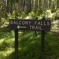 The Balcony Falls Trail begins at the Locher Tract parking area and follows an old road through the Locher Tract for 3.78 miles.
Off this old road, the trail turns right and meanders with a gentle climb through the woods along another old road. Upon approaching the James River Face Wilderness boundary, the trail begins a more sharp ascent over a series of switchbacks with panoramic views of the James River. The trail becomes easier at approximately 2,200 feet with a gentle climb along the ridgeline with scenic views to the east and west.
-
Buck Mountain Trail
Buck Mountain Trail is a very short trail that takes you away from the parking lot and instantly into a virtually untouched spot in nature. There are rocks to climb, trees to explore and wonderful spots to sit and listen to the birds around you.
Buck Mountain Trail is located in the upper parking lot of Roanoke Mountain Loop Road, located off the Blue Ridge Parkway at Milepost 120.
-
Buffalo Mountain Natural Area Preserve
 Buffalo Mountain, outside of Floyd, is one of the most significant natural areas in Virginia. It boasts an amazing 13 rare plant occurrences, three rare animal occurrences, and six significant natural communities. The combination of high-elevation (3,971 feet), wind-exposed openings at the summit, and magnesium rich soils make it unlike any place else in Virginia.
Public access facilities include a small parking area and a steep 1 mile hiking trail to the treeless summit.
-
Chestnut Ridge Trail
The Chestnut Ridge Trail is located along the Blue Ridge Parkway. It is a wide and well-graded path lined with mountain laurel and rhododendron and includes a 5.4 mile figure-eight loop trail that can be shortened to 2.5 or 3.4 miles.
The easy to moderate trail is just 10 minutes from Downtown Roanoke and is also adequate for horseback riders.
-
Crabtree Falls
Crabtree Falls is arguably the most beautiful set of waterfalls in Virginia. Billed as the tallest waterfalls east of the Mississippi, Crabtree Falls is a must-see for anyone who lives in the mid-Atlantic region.
Arrive at the top of the falls just 1.1 miles from the parking area and cross over a wooden bridge to an overlook. From here you can’t see Crabtree Falls below as it falls away, but there is still a nice view of the valley floor and the Blue Ridge Mountains. Don’t be tempted to climb over the stone wall onto the uppermost portion of the falls. The rocks are covered with very slippery algae.
-
Explore Park
 Explore Park, located adjacent to the Blue Ridge Parkway, is a 1,100-acre preserve, situated along the Roanoke River Gorge, offering both IMBA-certified mountain bike trails and access to hundreds of miles of the Blue Ridge Parkway. Mountain bike trail options (6+) ranging from 0.5 miles to 10+ miles, and includes a beginner bike skills area. Many of the trails are loop trails, and are easy to moderately difficult.
Explore Park also offers Treetop Quest aerial adventure course, Mayflower Disc Golf Course, river access, camping, cabins/yurts/RVs, and the historic Twin Creeks Brewpub.
-
Flat Top
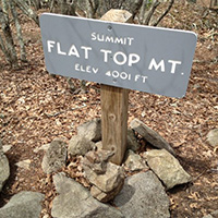 A classic Virginia 5.2 mile round trip (out and back) hike at the Peaks of Otter. Flat Top is a lovely trail full of wonderful views, large rock formations, and flora that changes with each turn, including huge oak, poplar, hickory, and beech trees, mountain laurel, rhododendron, and an assortment of wildflowers.
 -
Harkening Hill
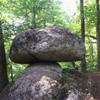 The lowliest of the three Peaks of Otter, Harkening Hill is the only one with a “loop” trail that swings by the top. A gain of just under 1,000 feet from the parking lot makes it a decent 3.5-mile walk. Harkening Hill sees far less traffic than the bigger Sharp Top, so the trail is in better shape. Many interesting granite boulder formations are found on Harkening Hill.
The loop trail that includes the summit of Harkening Hill starts immediately behind the visitor center. Side trips from the 3.3-mile loop include a trip to “Balance Rock” which is an impressive granite boulder balanced on a smaller one and a trip to Johnson Farm which provides a glimpse of the agricultural history.
If you park somewhere centrally at Peaks of Otter (such as the visitor center or the Sharp Top parking lot), you can hike the Harkening Hill loop and then link to the out-and-back hikes up Flat Top and Sharp Top for a total of about 12 miles.
-
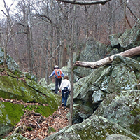
Rock Castle Gorge
 Rock Castle Gorge is an incredible 11-mile hike just off the Blue Ridge Parkway. There are several variations you can do for shorter mileage but completing the entire loop is worthwhile.
Sheltered within the deep, narrow confines of Rock Castle Gorge is a surprising variety of plant life. There are 200 species of wildflowers, 45 species of trees and 28 species of ferns along the trail. The gorge also has a stunning wildflower display boasting nearly 200 species from April through early May, all within day hiking distance of the Blue Ridge Parkway. The loop encompasses high, open meadows with an impressive panoramic view as well as the narrow confines of the Gorge, making for a strenuous, but rewarding day hike.
-
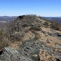
Sharp Top
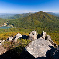 The sharp Top hike is a classic 3-mile round trip, out and back hike at the Peaks of Otter.
Sharp Top was long thought to be Virginia’s tallest mountain, when in fact, it is not even the tallest of the Peaks of Otter. Nearby Flat Top rises to 4,001 feet. Mount Rogers near the North Carolina border is Virginia’s tallest mountain at 5,729 feet.
Begin the hike at the Peaks of Otter Visitor Center. Cross the Blue Ridge Parkway staying on the sidewalk for about 200 yards and then turn right across Route 43 heading to the Sharp Top parking area. After crossing Route 43 there is an intersection on the left that leads to the Lake Trail. Stay on the sidewalk and the trailhead is to the left of the Camp Store. The trail is un-blazed but well worn.
For such a short trail to the peak, it will give you quite a workout with multiple series of steps throughout the hike. From the trailhead to the first good overlook is about 1 mile. Continue on the trail for about .3 of a mile and you will reach the Buzzard’s Roost Trail intersection. Bear left and go about 0.2 miles to the top. There is a stone cottage at the peak. The summit offers an impressive 360-degree view of the Peaks of Otter area.
-
Smart View Trail
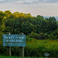 Smart View Recreational Area offers several hiking trails and picnic areas. Located along the Blue Ridge Parkway, Smart View also provides excellent views of the Virginia Piedmont. Three miles of trails meander through moist deciduous woodlands, hardwood forests, and open fields.
This site is a great place to bird during spring migration, but summer also is productive with breeders such as hooded, Kentucky, and black-and-white warblers, Acadian and great-crested flycatchers, blue-gray gnatcatcher, yellow-throated and red-eyed vireos, chipping sparrow, brown thrasher, and scarlet tanager.
-
Stewarts Knob Trail
 Stewarts Knob Trail is an easy half-mile hike located at milepost 110.6 on the Blue Ridge Parkway.
Create Your Own Land Adventure
Get Started Powered by Roanoke Outside