
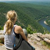
New River Valley Hikes
The New River Valley is home to great hikes. Grab your water bottle, lace up your boots, and go explore.
Here are a few places to start:
- The Huckleberry Trail is an asphalt-paved bike/pedestrian path, spanning from the library in Blacksburg past the New River Mall in Christiansburg. There are distance markers every half mile and benches spaced along the trail where you can rest and enjoy the scenery.
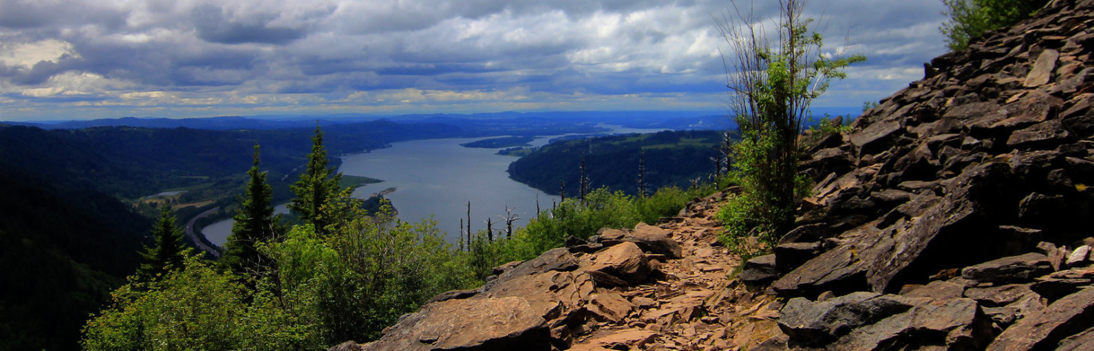
- Kelly’s Knob is a 6.6-mile, out and back hike on the Appalachian Trail, located on a ridge that bridges the valley between John’s Creek Mountain and Clover Hollow Mountain. While Kelly Knob is not the highest point on the ridgelet — the high point is densely wooded — it still affords a fantastic vista of the New River Valley.
- The Pandapas Pond & Poverty Creek Trails is a network of multi-use trails perfect for hiking, running, horseback riding, and mountain biking. There are more than 20 miles of trails with varying degrees of difficulty.
Find Your Hike
New River Valley Hikes
-
Angel’s Rest


 The climb to Angel’s Rest above Pearisburg is notorious among Appalachian Trail hikers for its punishing incline. You must endure a 1.5-mile, 1,650-ft. climb before you can sprawl over a boulder enjoying the view of the New River. The hike is 4.6 miles round trip.
The well-worn trail leads into a spring-fed ravine and briefly along an old logging road before settling into a consistent, thrashing course of switchbacks. The path crosses over two ancient rockslides and passes through thick poplar and oaks, as well as laurel and rhododendron.
Gradually, the thriving hardwood forest of the lowlands gives way to stunted oaks and shrubs. When you reach the boulders at the top, detour a few hundred feet to the right on a blue-blazed trail for a view of Pearisburg and the twisting New River. The A.T. continues to the crest of Angel’s Rest and follows along a rock ledge overhanging Wilburn Valley for spectacular views.
-
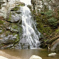
Cascade Falls Trail
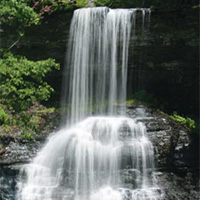 The trail leads to Cascade Falls, one of the most beautiful waterfalls (69 feet) in Virginia and possibly on the entire East Coast. Little Stony Creek cascades over a vertical cliff in several different streams.
- ~ 3.5 miles in length, out and back hike
- Easy to moderate difficulty
- There is a day-use fee of $3 (cash only)
- Map kiosk at trailhead (straightforward hike)
-
Dismal Falls
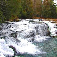 Dismal Falls is a 15-foot, multi-tiered waterfall on Dismal Creek. It is easily accessed from the road or from a side trail off of the Appalachian Trail.
Dismal Creek is about 50 feet wide (depending on water volume) at this point as it flows down over several ledges. The ledges on the left side of the falls are step-like while the middle and right ledges are more of a straight drop. In lower water, the middle and right are not covered and the stream is much narrower. Despite the width of the stream, the waterfall is not particularly open with trees lining each bank and throwing much of the falls into shade most of the day.
-
Falls Ridge Natural Preserve
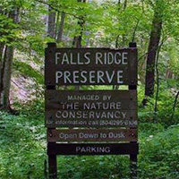 Falls Ridge Natural Preserve features two trails totaling 5 miles. With its nice hiking trails, beautiful waterfall, intriguing caves, rare plants, and convenient location, the Falls Ridge Preserve gets lots of attention. Falls Ridge Preserve is owned and protected by The Nature Conservancy.
Part of a steep, rugged ridge that rises from the valley of the North Fork of the Roanoke River, Falls Ridge Preserve boasts a spring-fed travertine waterfall approximately 80 feet in height.
Salem Fault runs through the preserve, dividing it into two different rock types-Precambrian limestone and shale/sandstone. The corresponding difference in soil types generates a diversity of vegetation, particularly wildflowers and smaller flora.
The rocks in the travertine falls watershed grew steadily, as minerals and lime dissolved in the water precipitate upon them. Over thousands of years, the build-up of calcium carbonate steepened the stream’s gradient and slowly created both the waterfall and one of the largest-known exposed travertine deposits. Large sinkholes on part of the land also indicate the existence of underlying caverns which have never been explored.
NOTE: Dogs are not permitted at Falls Ridge Natural Preserve.
-
Huckleberry Trail
 The Huckleberry Trail is an asphalt-paved bike and pedestrian path. The trail runs from the Blacksburg Library past the New River Mall in Christiansburg. There are markers every half mile and benches spaced along the trail where you can rest and enjoy the scenery.
Parking is available at both ends as well as near Warm Hearth and the Hightop and Merrimac Road crossings. The trail is 5.7 miles in length with easy walking and biking options.
-
Kelly Knob
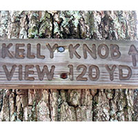 A 6.6 mile, out and back hike on the Appalachian Trail, Kelly Knob is located on a ridge that bridges the valley between John’s Creek Mountain and Clover Hollow Mountain and is immediately off of the Appalachian Trail. While Kelly Knob is not the highest point on the ridgelet (the high point is densely wooded), it is still much higher than its mountain neighbors with a fantastic vista of the New River Valley.
A shorter option (4 miles round trip) approaches Kelly Knob from the opposite direction.
Sandstone bedrock forms a broken escarpment along the east and south of the ridge, and the area around Kelly Knob is particularly striking with 50 foot cliffs containing deep fissures in the rock. The trails to Kelly Knob are well signed and traveled.
-
Mountain Lake Conservancy
 The Mountain Lake Conservancy manages 2,600 acres of mountainous terrain that encompasses a unique ecosystem due to an average elevation of more than 4,000 feet.
More than 20 miles of fern-lined trails on the property are open to the public for biking year-round. The trails are home to the “Dirty Dawg MTB Race” and offer trail options for all experience levels. Mountain bike rentals are available at Mountain Lake Hotel.
-
Pandapas Pond & Poverty Creek Trails
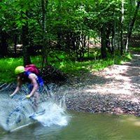 The Poverty Creek Trail system (also known as Pandapas Pond) is a network of multi-use trails perfect for hiking, running, horseback riding, and mountain biking. There are more than 20 miles of trails of varying degrees of difficulty.
Poverty Creek Trail is the easiest of the trails in this system. It is a series of small ups and downs and is ideal for mountain bikers of all skill levels but especially great for those just getting into the sport. Think of Poverty Creek Trail as the “spine;” many trails branch off of Poverty Creek that are more challenging.
-
Stiles Falls
 Stiles Falls is a 40-foot waterfall located on Camp Alta Mons property. The trail is closed to the public while summer camp is in session.
The hike is about 3 miles long. From the camp office, walk up the road past the swimming pool, the retreat center, and the pond. Continue along the dirt road until you come to a sign indicating “Falls.” Follow the trail to the falls crossing the creek three times before reaching the falls. The trail is marked with white blazes.

Create Your Own Land Adventure
Get Started Powered by Roanoke Outside